Firstly, I know I’m a little behind with the new post about Yeovil Town. I have everything in place, however, I have an awful lot of photos to go through, and only want to use the best of them. The others, which are still fascinating, I will put up as a gallery at a later stage.
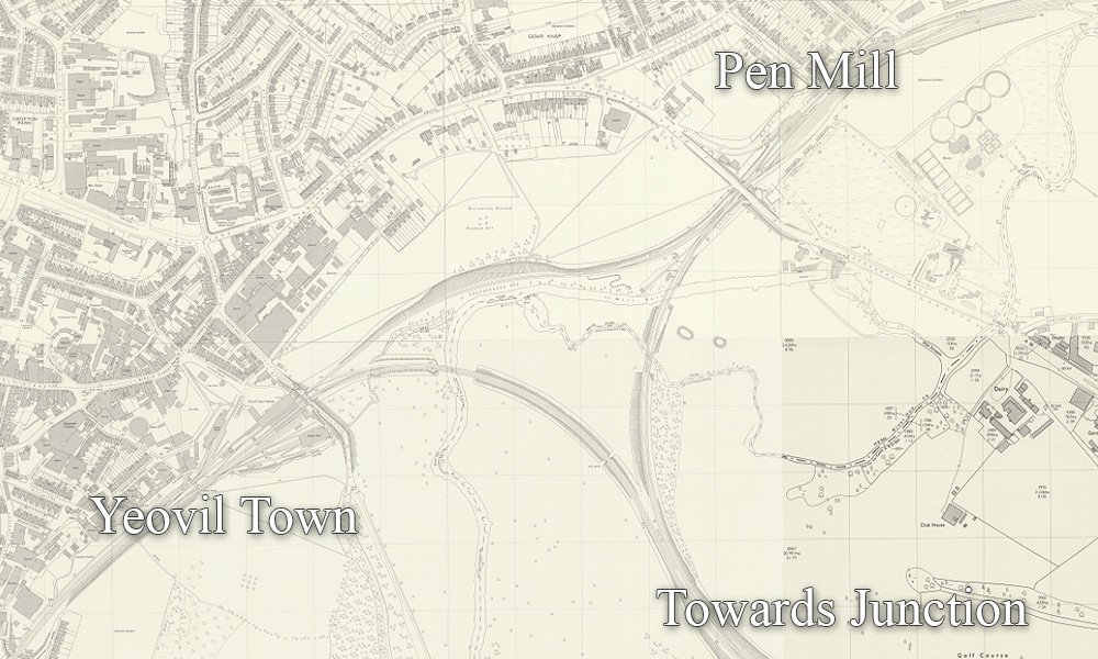
Yeovil Town was on the line to Taunton, however there was a triangle, between Pen Mill, Town, and Junction.
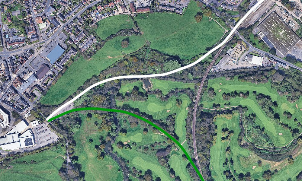
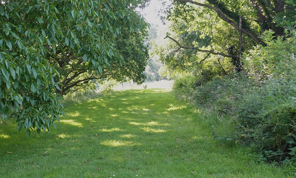
As you can see, the area is now all gown up, with the trees all much bigger, obviously. The white line is the walkway to Pen Mill. The green line is where the old line would head south, join with the Weymouth route, and on to Junction.
Butterfly Junction
The Yeovil triangle was a busy area, running trains between the three stations. Before heading into Pen Mill, was Butterfly Junction.
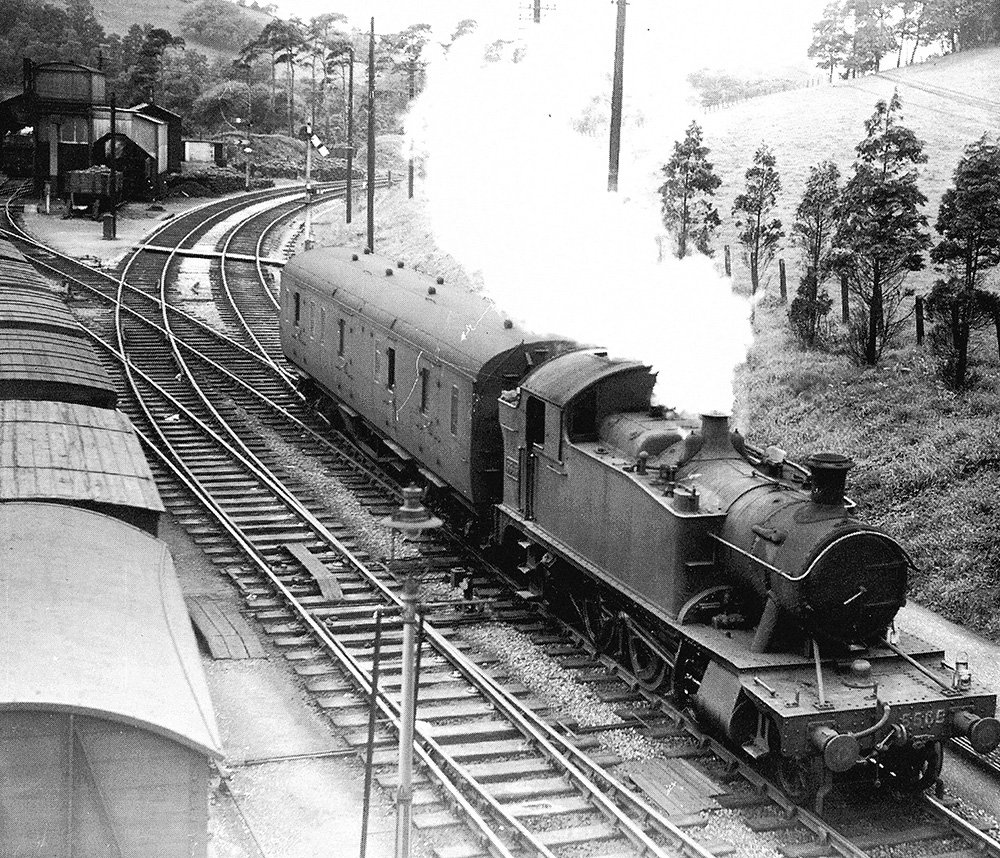
Here is No 5565 with a parcels van, coming off the single line from Town station on the 3rd Sept 1950 just past Butterfly Junction. In the background is the former GWR engine shed, with the cattle wagons are on the left. Image by Lens of Sutton.
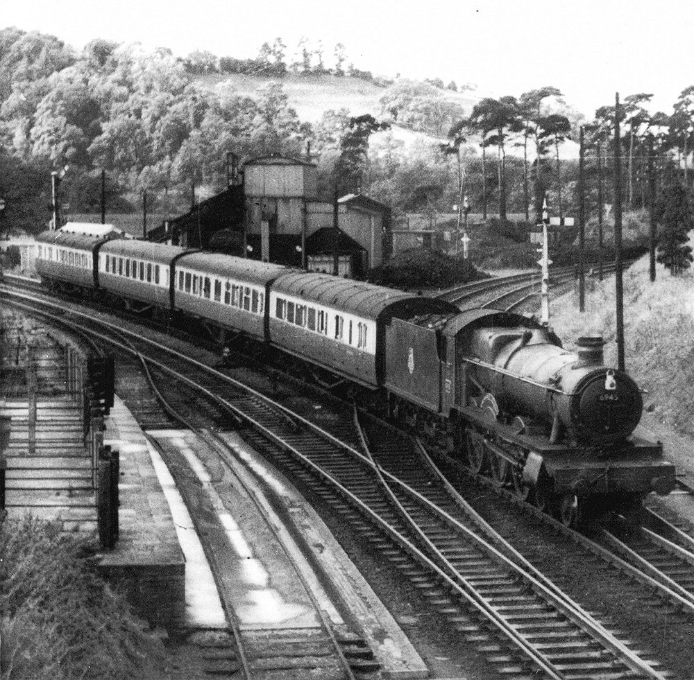
No 6945 Glasfryn Hall arrives from Weymouth. On the left, the paved area received cattle wagon washings; the railwaymen were pleased to see the end of this ‘dirty traffic’ on the 1st Jan 1963. Date unknown. Image by C. L. Caddy coll.
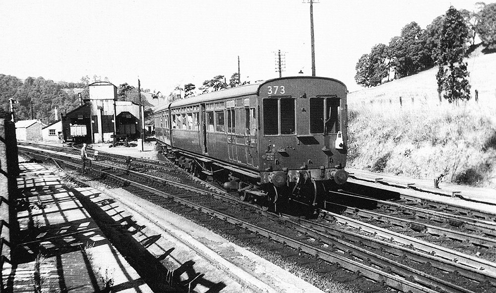
Here is the shuttle to Town about to pass the ex-GWR locomotive shed on the 7th July 1959; the shed had closed on 9th Jan the same year. Coach 373 had been part of a steam railmotor until 1919 and remained in use until June 1960. Image by H. C. Casserley.
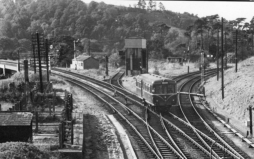
The final allocation to the shed had been two class 4575 2-6-2Ts and six class 5700 0-6-0Ts. There is a clearer shot of the cattle dock (left), which was used up until 2nd Feb 1964. The railbus is working the short-lived Junction-Pen Mill service, taken on 13th Oct 1966, and had just passed the banner repeaters for the South Junction. Image by H. C. Casserley.
Butterfly Junction Today
Today, the entire area is hidden and you have to get off the beaten path.
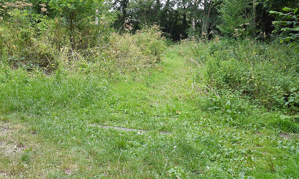
Just off the main cycle path, there are still some sleepers, now buried in the grass, but still waiting for the next train.
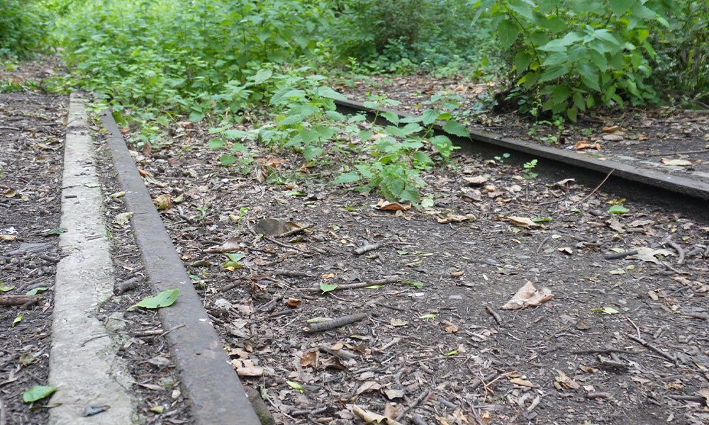
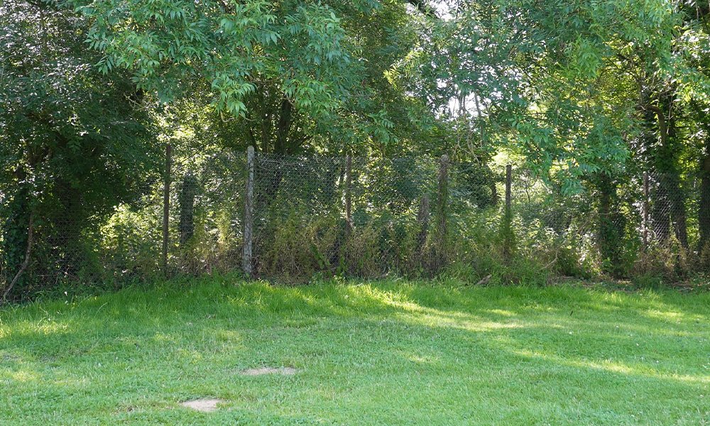
As you venture further into the woods, there are rails, and some brickwork, left over. It’s difficult to tell exactly where this was, possibly where the cattle dock was?
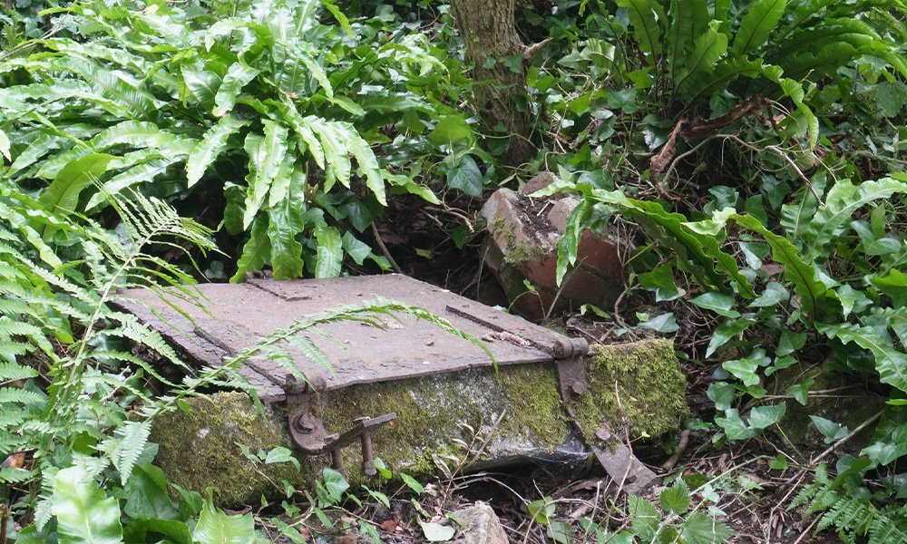
Just next to a pile of knocked down wall, there is a door, or manhole cover, of some kind. Again, it’s almost impossible to say where or what this was.
Pen Mill to Yeovil Track
The line that ran from Pen Mill to Yeovil Town is now a walk and cycle path. The area today is call Nine Springs, and you can walk the old trackbed, from where Yeovil Town was, to where Pen Mill still is. It’s a local beauty spot and a great place for dog walkers, picnickers and just a very pleasant walk.
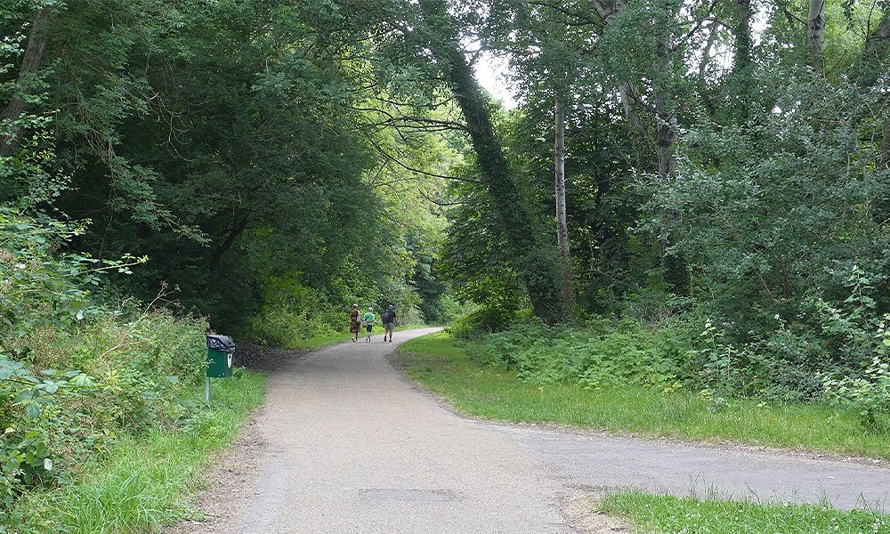
This is just outside of the Yeo Leisure Park over flow cark park, looking east, towards Pen Mill. The old track bed is now a very well kept cycle and walkway, and a delightful nature park.
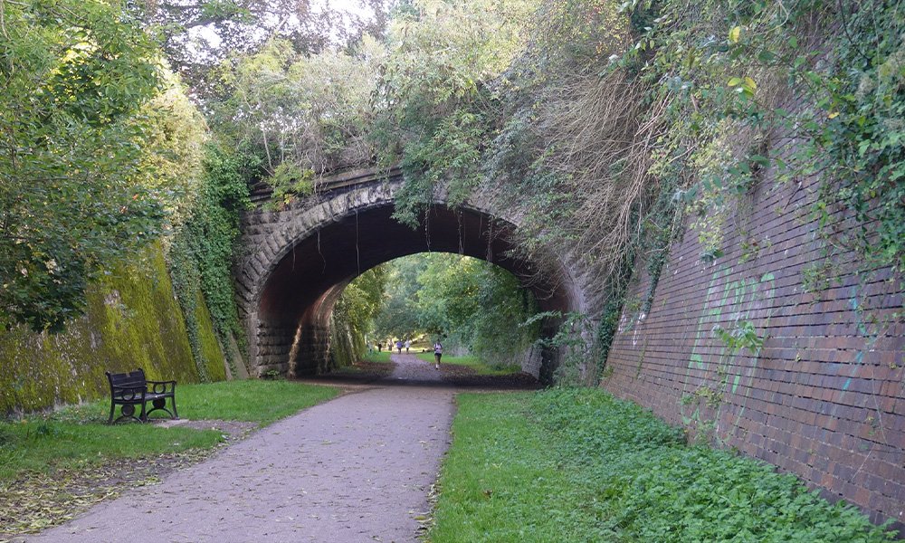
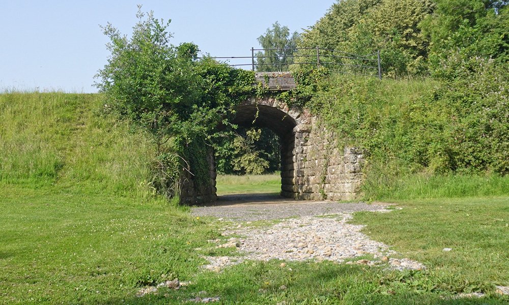
The impressive bridges are still standing proud over the old line, this is a little further west, heading towards where Hendford used to be. In an up and coming post about Hendford, I will go more into the bridges, with more photos.
The Pen Mill to Weymouth Line
I’ll be focusing on the Nine Springs area in the blog post about Yeovil Town, but this post is about the how the line went from Yeovil Town to Junction; which is sadly no longer there.
The old line goes through the Yeovil Golf Club. I contacted the club and asked if I could get permission to film where the line used to be. They were happy to oblige, and I went over to see their stunning golf course, and film what remains of the track. I haven’t played golf in a long time, so I only took my camera, not a 5 Iron.
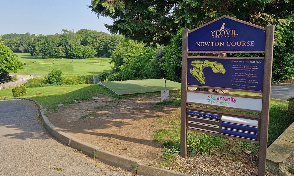
You can still clearly see the live track today, which connects Pen Mill and Junction, and down to Weymouth. The active line goes right through the middle of the golf course, and still has the original bridge, between holes 4 and 8.
It’s wonderful to see that a bridge, over 100 years old, made without any computers or AI; is still standing.
Yeovil Town to Junction Line
The old trackbed, between Town and Junction, leaves the over flow car park at the Yeo Leisure park, heads through some private ground, and then goes through the Yeovil Golf Club.
I have been to the club in the past, to the driving range, but had no idea how beautifully kept the entire course is.
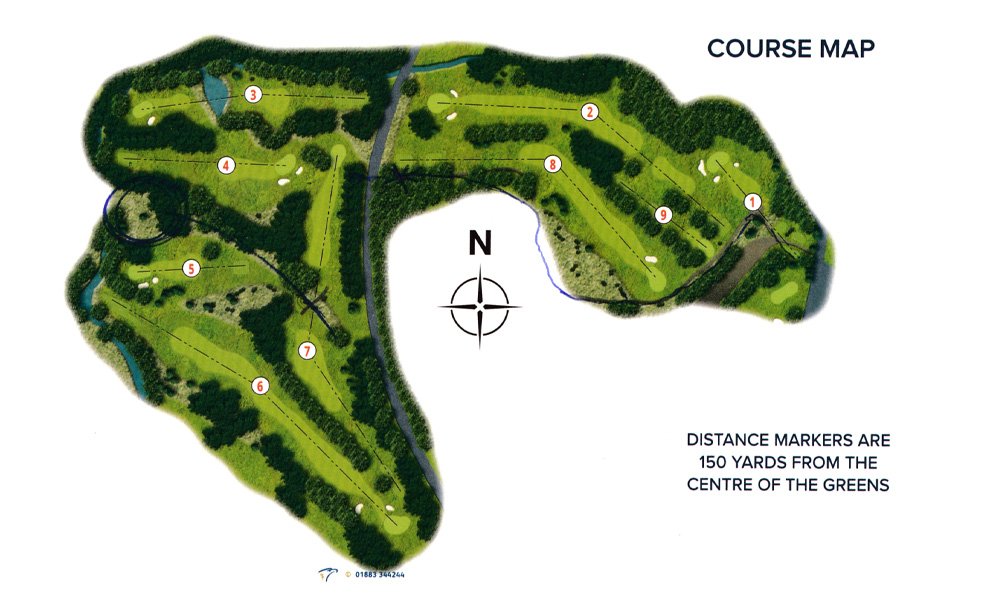
As I said, the course is impressive, but I was given the above map and directions on where to head. I was hoping for a gold cart to drive around on, but alas, I had to walk. It was on one of the hottest days of the year, which didn’t help. It was first thing though, and the walk was worth it.
Over the Yeo
The line crossed the Yeo River, over Cricketsham Bridge.
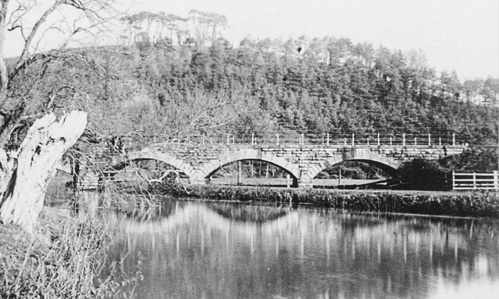
This image was taken circa 1880. In the background, you can see Wyndham Hill, with those famous, landmark trees, as saplings. Back then, everything was new, tress where young, and the river looked very inviting; especially in this kind of weather.
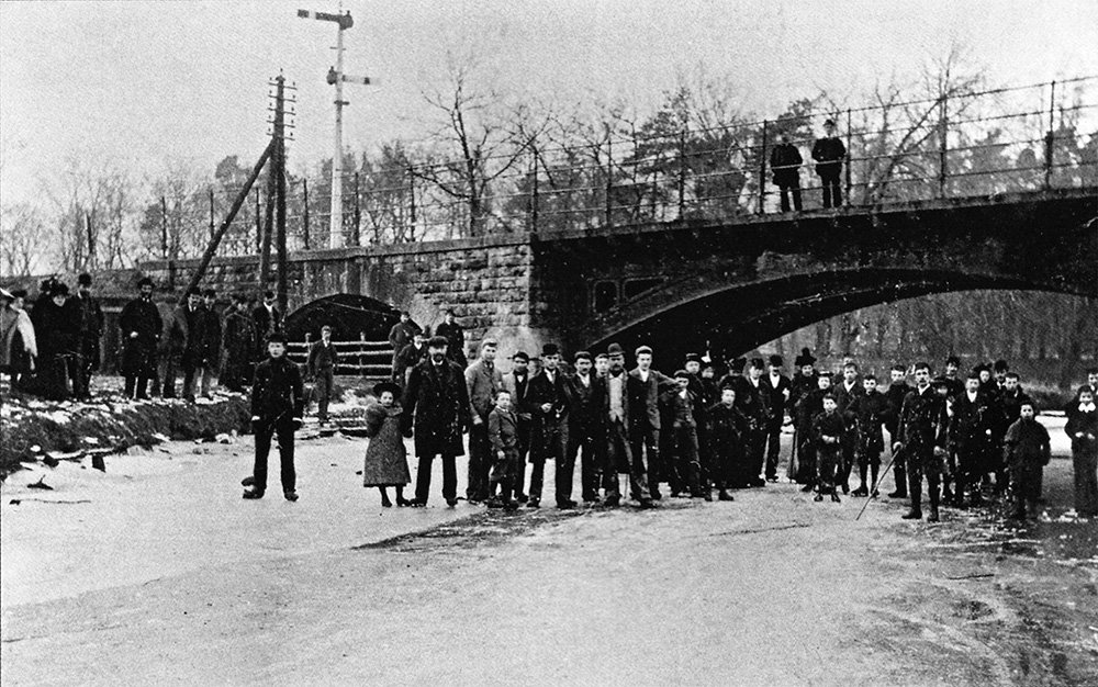
This stunning image is from the book Yeovil Golf Club Centenary 1907 – 2007. The photo is entitled Ice Carnival at Cricketsham Bridge – Feb 1895. Obviously, there was a big freeze that year, and the River Yeo froze over.
What is interesting about this image is that you can clearly see the different materials of the bridge. Sadly, the right hand side was removed from over the river, but the rest of the bridge remain, as you will see below.
The bridge was in use up until the end of closure of Yeovil Town. It closed to passenger traffic on 3 October 1966, but freight and parcels traffic continued to use the station until 3 March 1967, when these services were also withdrawn. The bridge that passed over the river, was demolished, but many of the arches still survive, on and through the golf club.
Cricketsham Bridge Today
The good news is, the bridge is still there, but sadly, no longer in use. Since it was closed, when Town shut, it was no longer needed. Some of the trackbed is in use as a walkway for the golfers, but the a lot of it is now over grown.
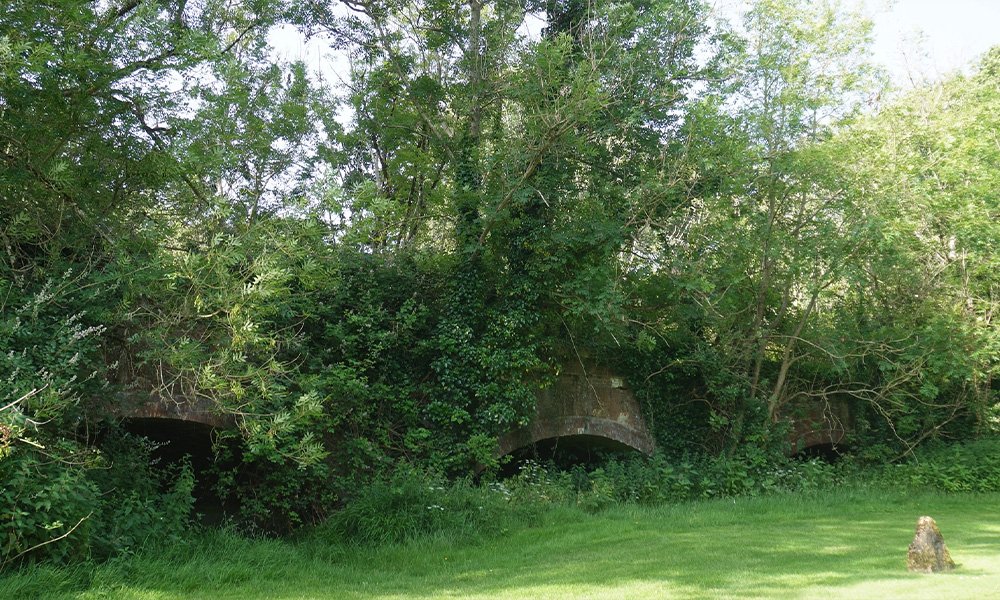
This is with Wyndham Hill behind the camera, and the river is to the right. Just the left of this picture, you can walk under the bridge arch to go from hole 4 to 5. The grounds of the golf course are kept pristine, but the areas, where golfers don’t tend to go, unless they happen to lose a stray ball, are over grown. It was difficult to get closer.
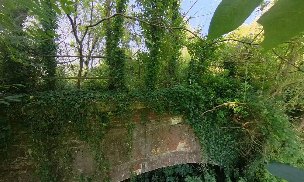
However, by using a long selfie stick, I was able to show what the top of this part of the bridge looks like. It’s been a few years since anyone has been down there, and even longer it has seen a loco thundering over.
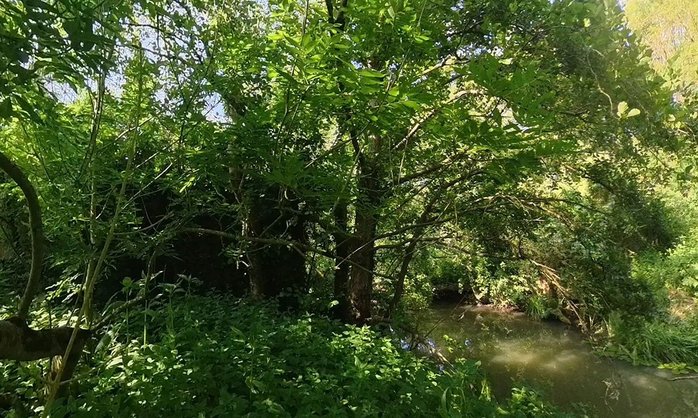
Again, not the best image, but this is looking at the end of the bridge, with the section over the river now removed. I chatted to a couple of the club’s regular golfers about the old line. One of the gentleman told me, as a young lad, he would sit on the edge of the bridge and go fishing. He smiled as he told me that was a good few years back now.
Further Down the Line
As we leave the bridge and head towards the south, towards where the disused line would meet the Weymouth line.
Walking between the 4th and 5th hole, if you don’t go under the bridge, you would walk up to the old trackbed, which you can still walk along.
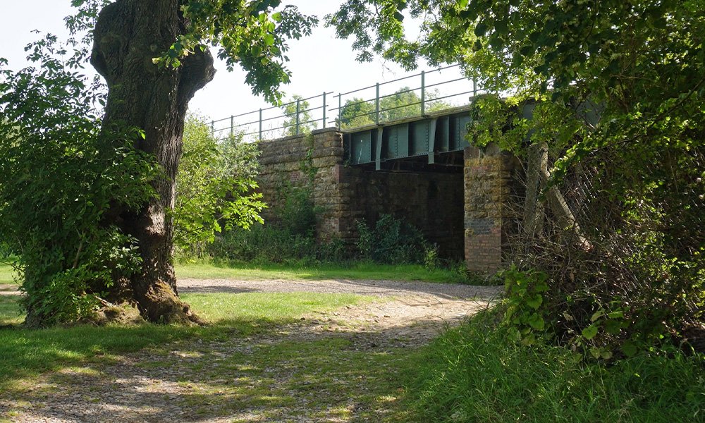
Technically, on the course, you walk up one side of the bank, down the other to the next hole. However, you can walk southwards, towards another, smaller bridge, which is part of the 7th hole.
Hole 7 is a par 5, and you would pass under bridge that carried the line south, towards Junction. Again, it’s an impressive piece of engineering that has stood the test of time. Yes, the railings are not in mint condition anymore, but the spirit is still there.
And here it is, the end of the line, just before it would have met the Weymouth line. The entire area fenced off for safety, and nature has taken over. Where the south side of the Yeovil Triangle would converge, is now lost in time. At least the Weymouth line is still in use.
Behind the Scenes
The good thing about making the video about the Yeovil to Taunton line, means I can shot locally, as I live here now. As a new part to these blog posts, I thought it might be nice to add some behind the scenes photos, and you can put a face to the voice on my videos.
Something I need to explain before we go on. I don’t really like having my photo taken, so if I do, I usually pull a face or try to make them funny. Selfies on my phone are always off centre, this is just me being silly.
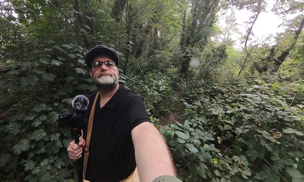
Here I am, a little lost in the woods, looking for the remains of the old GWR shed. As you can see, it’s now very over grown, with lost of stinging nettles; which only got me twice.
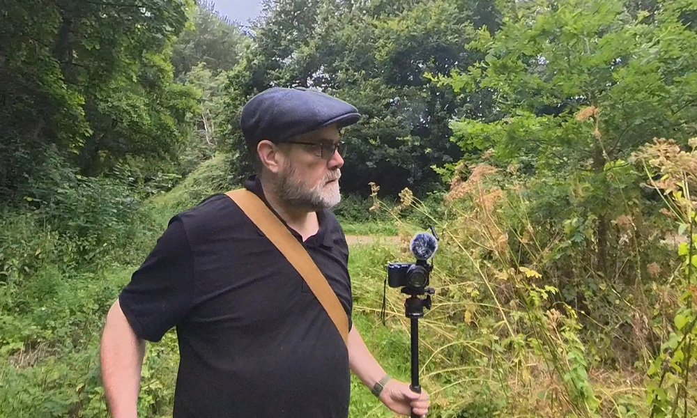
Just as you head off the main walkway at Butterfly Junction, there are butterflies. Well, not today there wasn’t, I waited for ages and just couldn’t get close to any. I can appreciate the effort nature camera people have to go through, there’s a lot of waiting around.
At Cricketsham Bridge
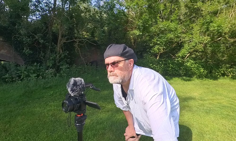
Here I am on the tee of the 4th hole, with the Cricketsham Bridge behind me. I’m in my Cecil B. DePhil hat, which is just a peak cap turned backwards. I like to think it makes me look like Cecil B. DeMille, the director of movies like The Ten Commandments and The Greatest Show on Earth; he famously wore a barrette while filming.
I have a Sony ZV-E10, which is not the most expensive camera on the market, but I like it. It will shoot in 4k and is small and compact. The lens is standard, as I don’t tend to need anything fancy. I find half the fun is shooting, and the other half is editing and colour grading at the computer.
Bad Selfie
This was between the 4th and 5th holes, at the top of the bank, looking south towards where the lines were meet.

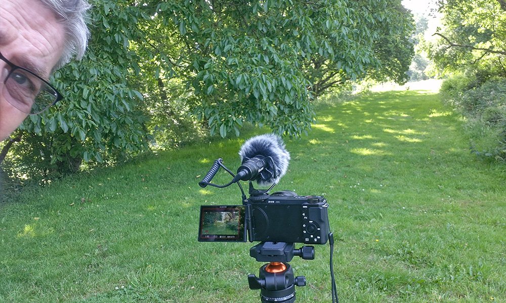
Here I am on the 7th hole, filming the walkway under the old trackbed. I took this image with a 360 camera, which means I don’t have to worry about where it’s pointing, as it’s pointing everywhere, all at once.
Filming has changed a lot since I used to go out with dad. He would have loved a 360 camera, but the technology was way off back then (dad passed away in 2001).
Up Next
I will admit, I thought this post was going to be a short one, mainly focusing on the line that runs through the golf course. The more I looked into it, the more interesting it became.
A huge thank you to the Yeovil Golf Club for letting me film on their land and use of their images. The club seems very popular and I can see why, as I said, the course it in beautiful and set in a stunning vista.
Also, thank you to Derek Philips for the use of the image from his book: Working Yeovil to Taunton Steam. His book is a fantastic read, about the history of the line, but also has some wonderful personal stories. As always, thank you to Middleton Press for the use of their images from their books.
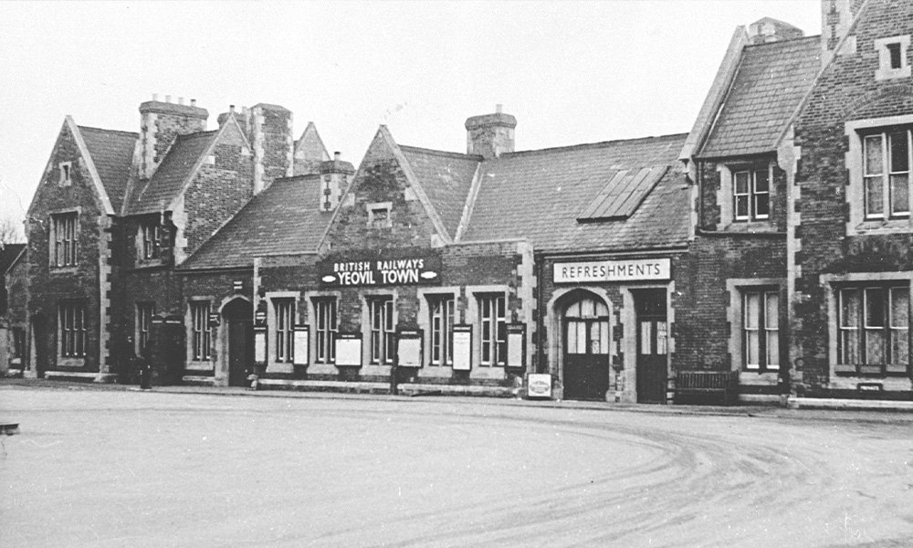
Next on the line was Yeovil Town station, which was very impressive.

This Post Has One Comment
I was born on 7th May 1953 and was introduced to Hendford Halt a few days later. I became a lifelong enthusiast for railways there and then. I have to admit that I didn’t know the name of that bridge and had never heard of Butterfly Junction, even though I’d passed over it many times! Have you joined the Yeovil Railway Centre, by the way?
Keep up the good work!