
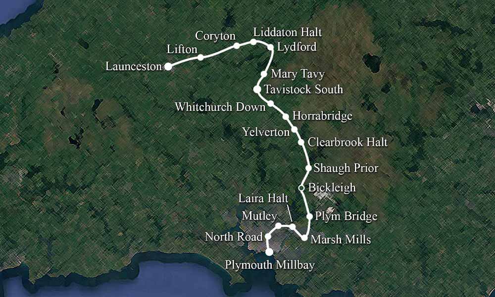
This won’t be the longest of blog posts this week, as there isn’t much information on Lipson Vale Halt, which was one of the stops on the Plymouth to Launceston line. In fact, on the original map we made for the video. It was just west of Mutley and before Laira Halt.
It was even difficult to pinpoint on older Ordinance Survey Maps.
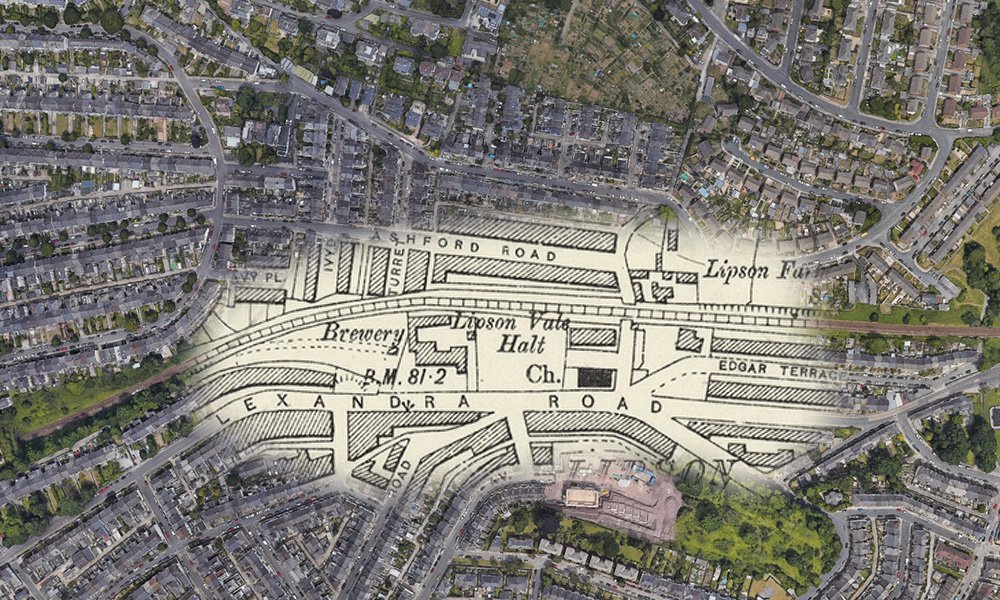
Images of Lipson Vale Halt
As I said, there isn’t much information on Lipson Vale Halt, as it wasn’t very big.
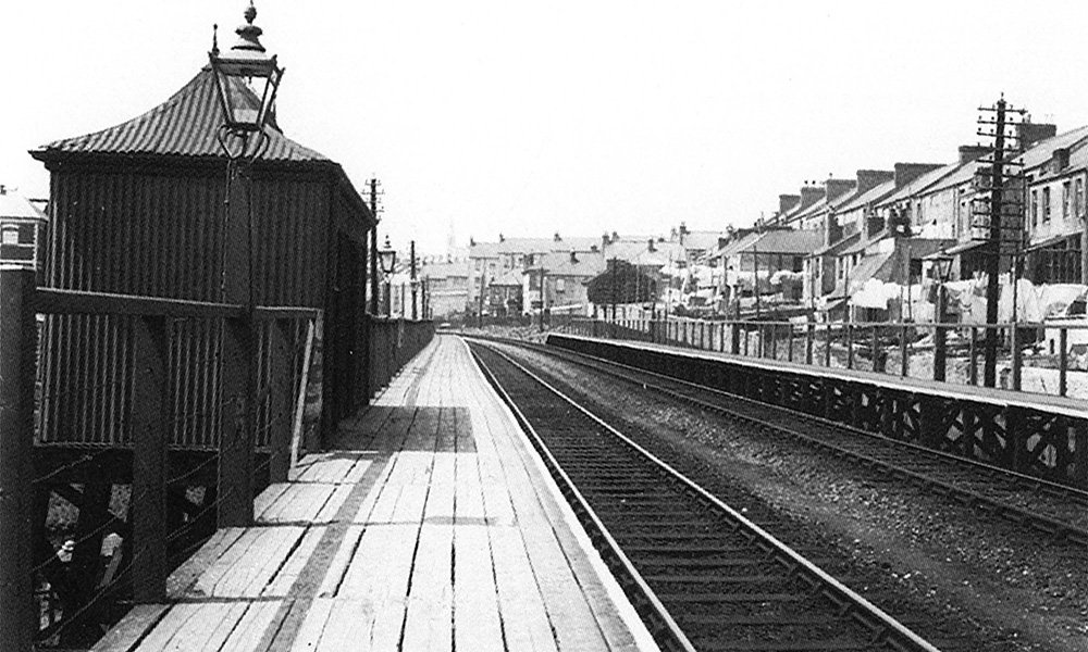
Looking westward, towards Mutley Station, the platforms were made of wood, were brought into use on the 1st June 1904, when the halt was opened by the GWR. The halt was used because of the high density of housing around it. This photo is circa 1922. Image by LGRP.

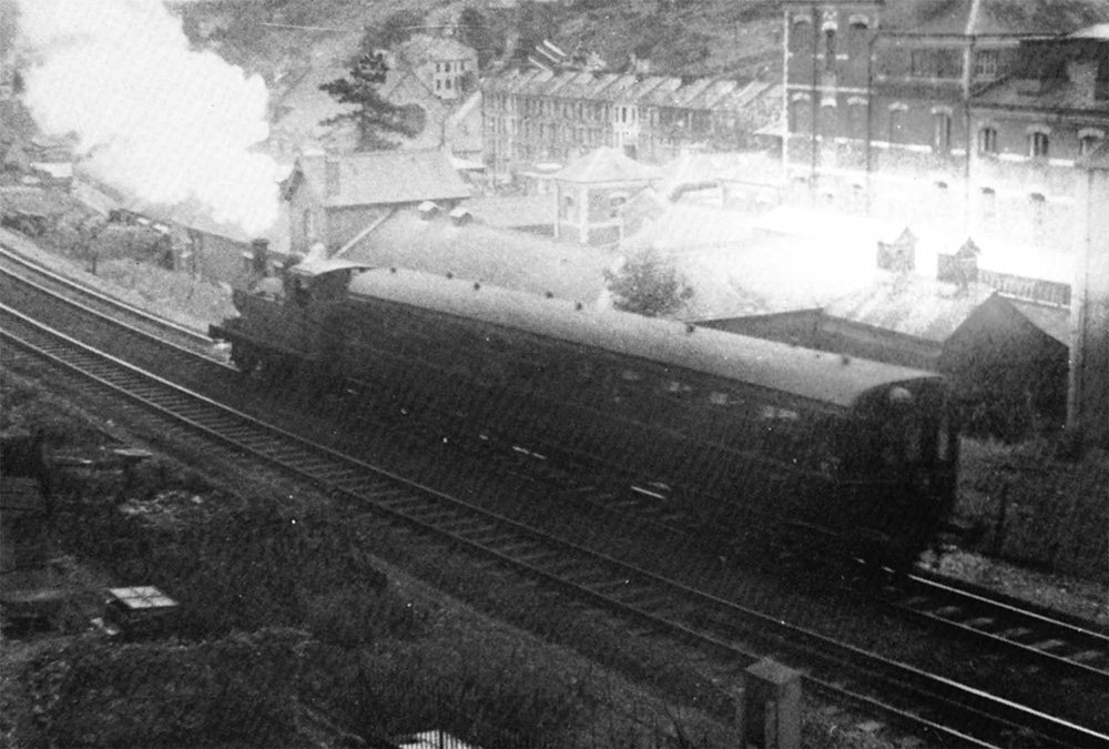
This time, June 1935, No. 7760 heads eastwards, to the next stop Laria Halt. Lipson Vale remained in use until 22nd March 1942. Image by H. C. Casserley.
Not the best of images, but this shows the 3:50pm auto train from Tavistock, as it passes the rear of the former Beechwood factory near the site of Lipson Vale Halt. Taken late 1950s. Image by W. E. Stevens.
Lipson Today
I’ve not been able to get to Plymouth, at the location of the halt, so these images are from Google Maps.
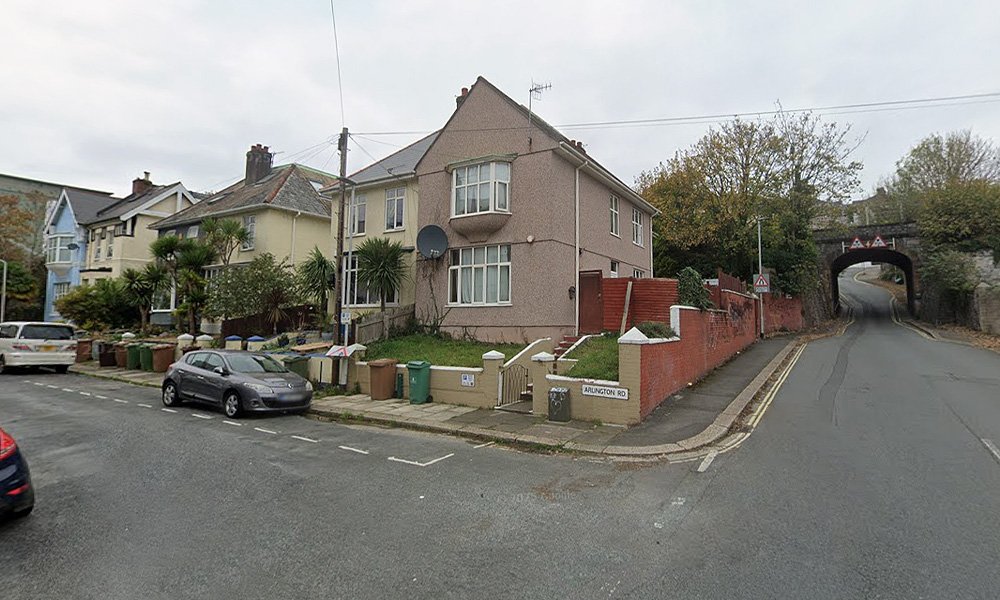
This is stood on the corner of Arlington Road and Ashford Hill. Lipson Vale Halt was just up behind these houses.
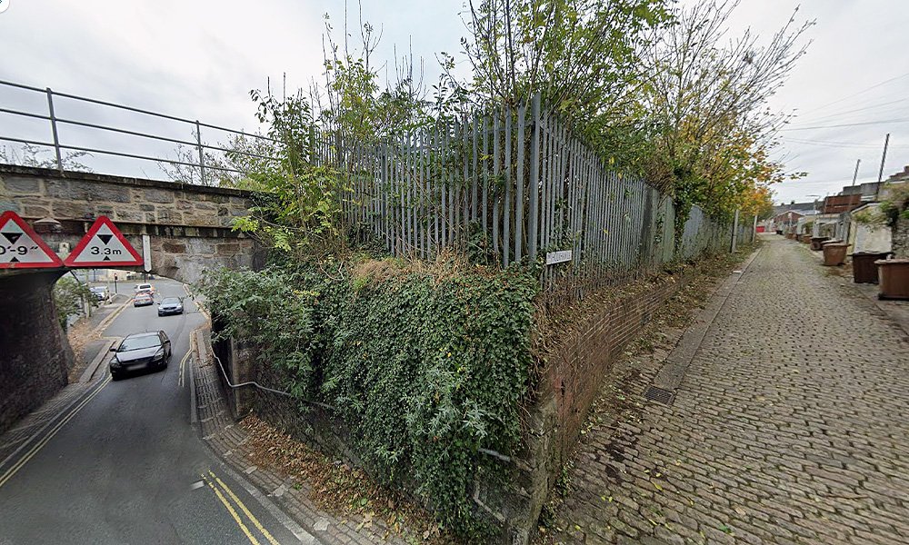
Up Ashford Hill, the other side of the of the bridge, you can see down Holkham Lane, which is the back of the houses on Ashford Road. This would have lead up to the halt.
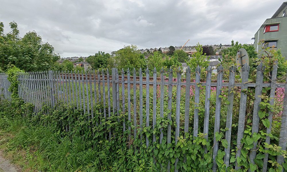
Standing in Holkham Lane, this is all that remains of Lipson Vale Halt; sadly, nothing. The line is still active, but the nothing remains of the halt, no platform, no shelter, no way of even approaching where the halt used to be.
Lipson Junction
I found a couple of images from Lipson Junction, which was as you left the halt and headed towards Laira.
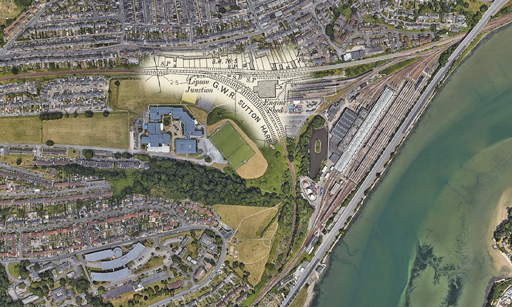
Just north of Performance Arts Academy, was Lipson Junction. Heading to the south was the GWR Sutton Harbour branch. The line off to the east was the GWR line, that ran along Embankment Road, this line is still in use today. The southern apex of the triangle is Mount Gould Junction and beyond that is the carriage washing plant, situated on the old route to the Friary terminus.
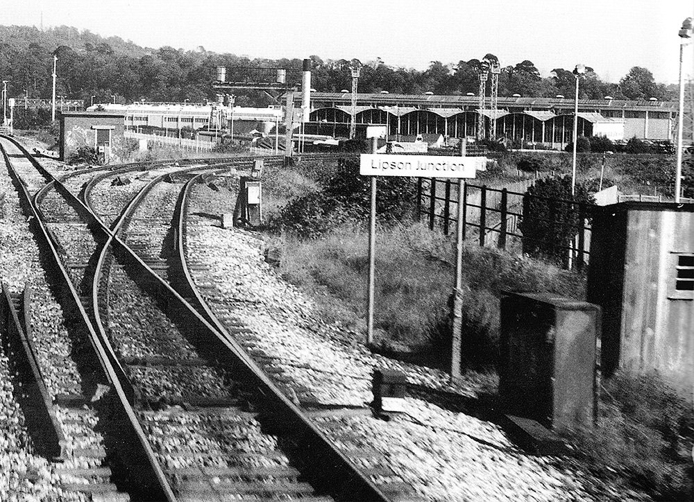
This is Lipson Junction in 1996, with the diesel depot in the background. The left track is for movements northwards only, whereas the other is reversable. Image by V Mitchell.
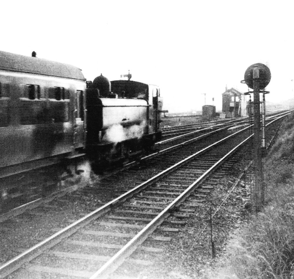
No 6419 approaches the junction with a train from Tavistock, on 15th May 1960. The signal box opened in April 1891 and was used until November 1960, when the Plymouth Panel took over its function. It had 35 levers at that time and was one of the busiest boxes in the area. Image by M Dart.
Next Up
Next on the line from Plymouth to Launceston was Laria, which will be the next blog post.
Once again, thank you to Anthony Kingdom for use of his images from his book The Plymouth, Tavistock and Launceston Railway. Also the use of some images from the books by Middleton Press.