
We have seen Tavistock South in all it’s glory, but this blog post won’t be as cheerful. With the closure of the Plymouth to Launceston branch line, the station was closed, the track was removed, and nothing much remains of the station.
After the Closure
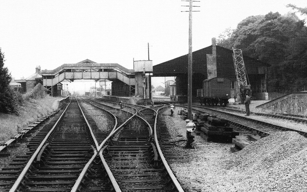
On the right of this image from 1963 is the loading dock and crane, which could lift eleven and a half tons. There was a siding for the gasworks south of the station from 1938 to 1957. The yard had been very busy towards the end of World War II, owning to the large number of Army camps in the area. Image by C. L. Caddy.
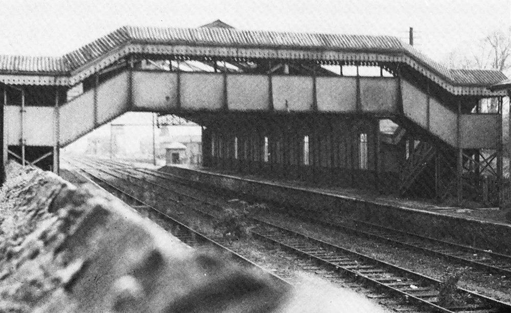
Viewed over roadway wall looking toward Plymouth and showing close up of the station buildings and foot bridge. Taken 1967. Image by C. G. Lennox-Jones.
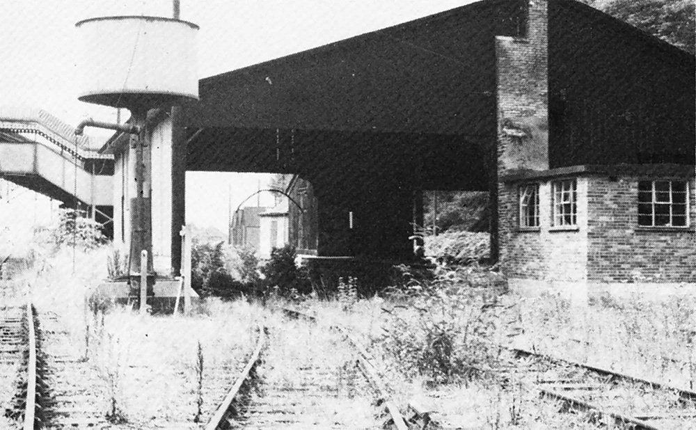
Another view shows the goods shed showing details and more recent additions to it. Taken 1967. Image by C. G. Lennox-Jones.
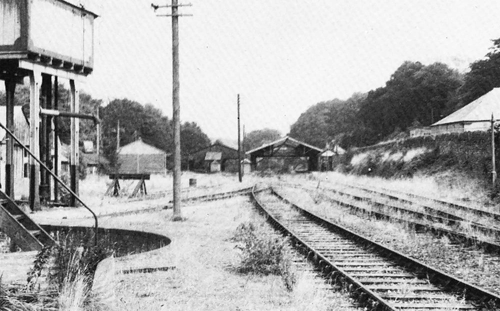
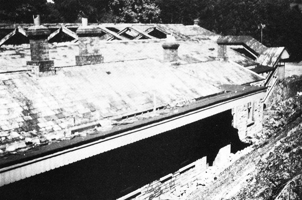
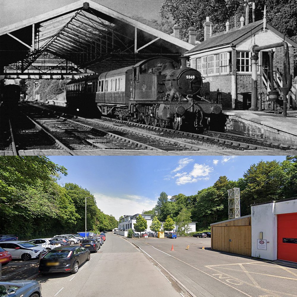
Looking north towards Lydford showing also the turntable pit, water tower, goods shed and signal box. Taken 1967. Image by C. G. Lennox-Jones.
Sadly, demolition of Tavistock South during the summer of 1968 – Spring 1969. Outside of station building and approach road from the bank. Image by the late F. J. T. Elliot.
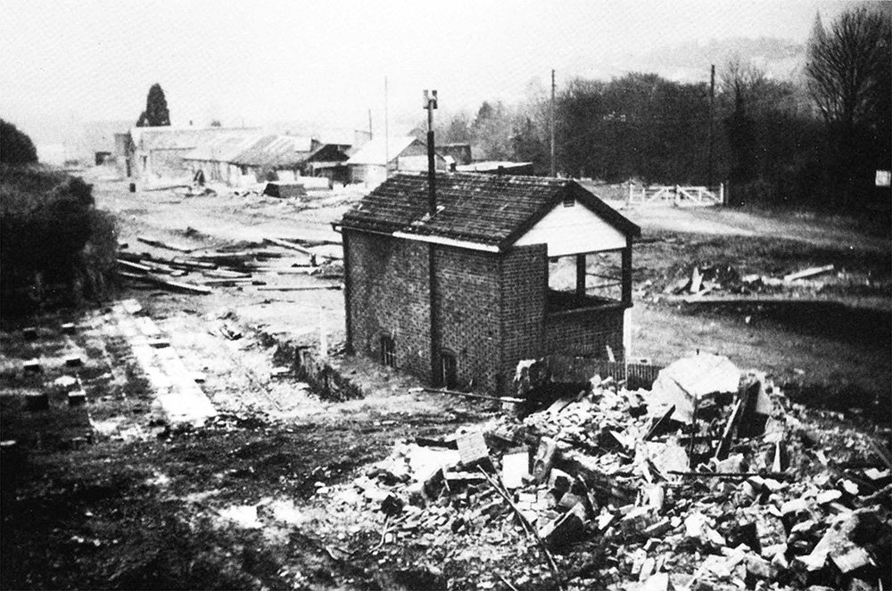
Another view of the demolition of the station, during the summer of 1968 and spring of 1969. The signal box and cattle dock looking south from wreckage of station buildings. Image by the late F. J. T. Elliot.
Tavistock South Today
There is nothing left of the station today, the following images are from Google Maps.
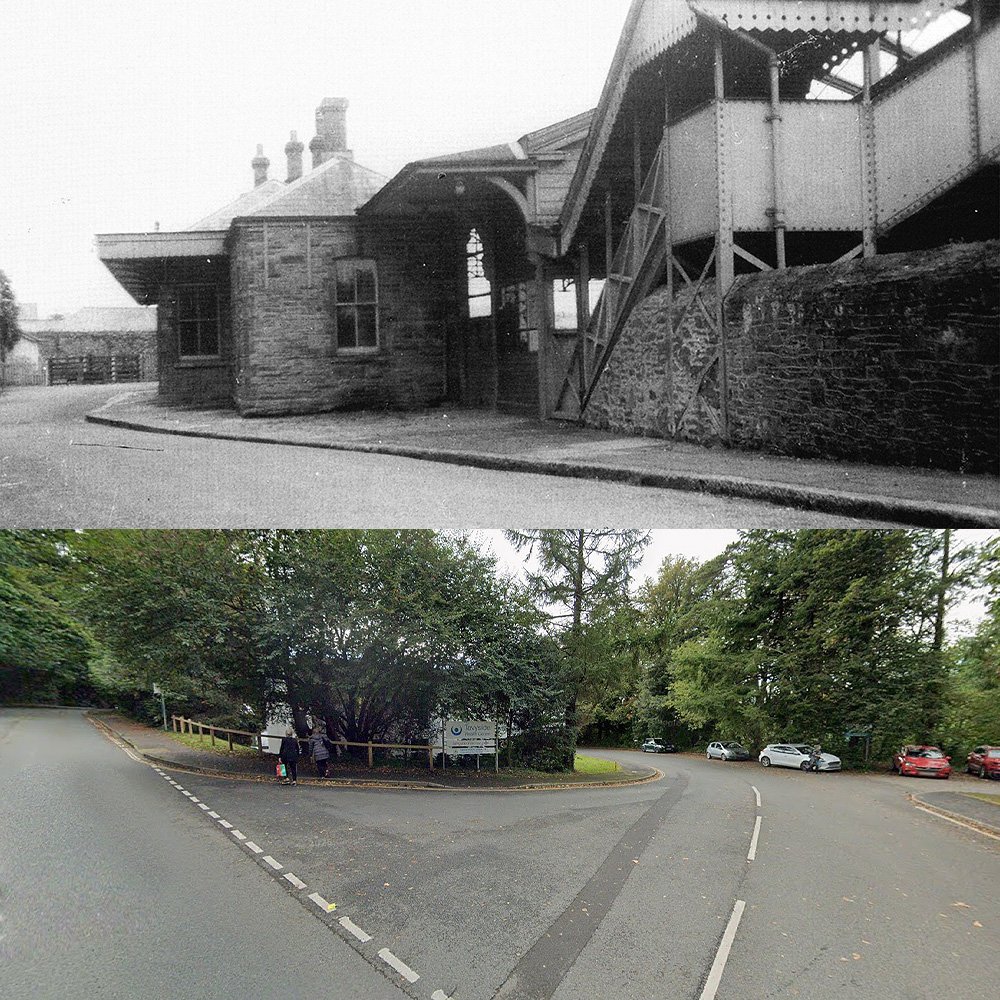
Is the location of the entrance to the station. Once, an impressive building, with stairs leading to the foot bridge. Now, it’s the entrance to Abbey Rise, off Whitchurch Road, which was Old Plymouth Road.
This is at the north end, looking south (westerly) down what should be the track bed, well, as close as I can get. There is nothing left of the track or buildings.
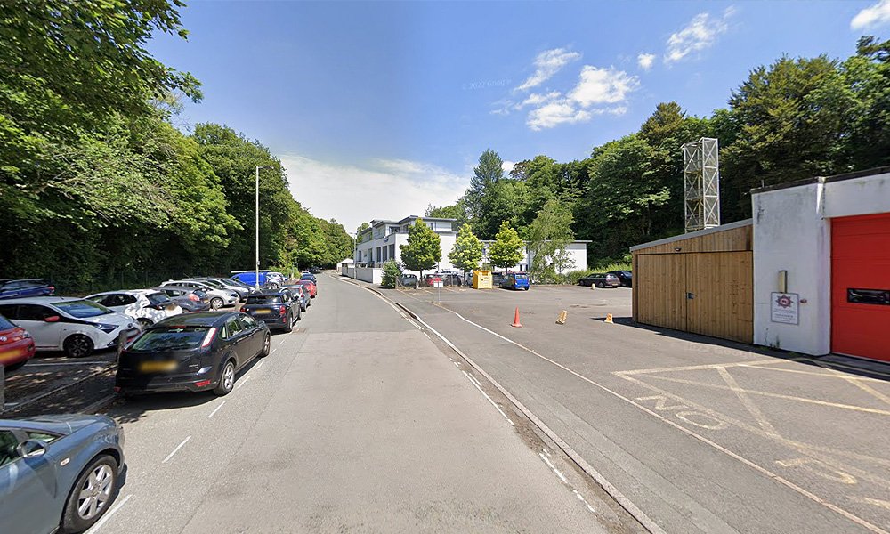
This is the southern end, looking north (easterly). Again, there is nothing left to see of the line or buildings.
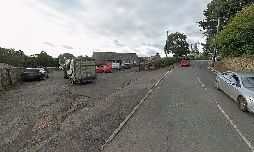
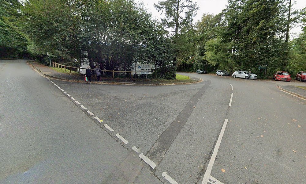
This image is again from the southern end, looking north towards where the cattle market was. It’s now the Tavistock Livestock Centre owned by Stags, according to Google Maps.
Tavistock – Then and Now
It’s very difficult to see exactly where anything was, as you can see from the images above, but here is my best attempt at some then and now comparisons.
All gone. I mean, it’s not like the main building from the outside was the prettiest of structures, but it was still an impressive sight to behold as you would turn up for your trip.
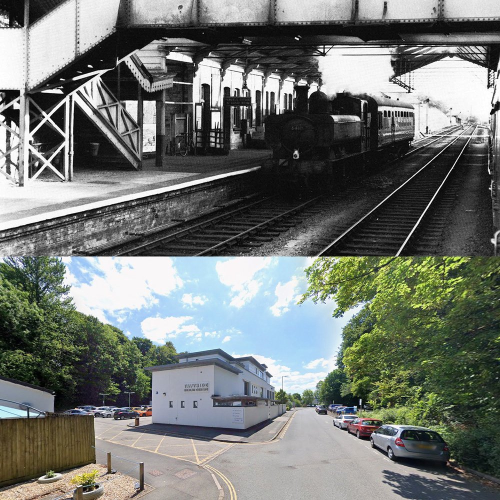
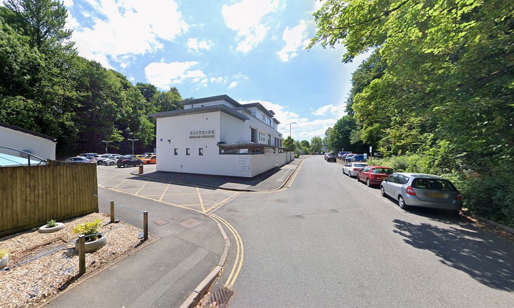
The footbridge, all gone, no track and the buildings are now less impressive. There is nothing wrong with the Tavistock Health Centre, it’s just not as nice looking as the station building from over 100 years ago.
So sad to see, Tavistock had two impressive stations, this one, the south, has nothing left.
Up Next
The next stop on the line was Mary Tavy, as the Plymouth to Launceston branch line carried on across the moors towards Cornwall and into Launceston.
The wonderful archive images have been provided by Anthony Kingdom from his book, The Plymouth Tavistock and Launceston Railway, and with kind permission from Middleton Press and their series of books of the railways from around the UK.
If you haven’t yet, check out the video I made with dad, Plymouth to Launceston via Tavistock South. It tells the story of the entire line, with exclusive archive movie footage, and stories from the branch line.