
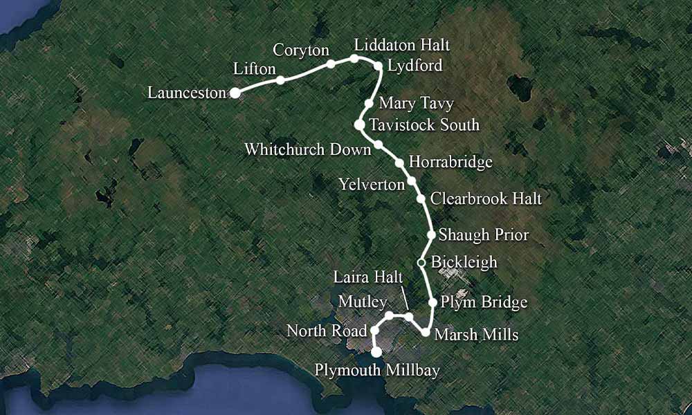
If you know Plymouth, you know Mutley Plain. Personally, I’ve spent many a happy hour in Goodbodies, usually enjoying a good breakfast. After leaving Plymouth North Road station, on the way to Tavistock and Launceston, the next station would have been Mutley.
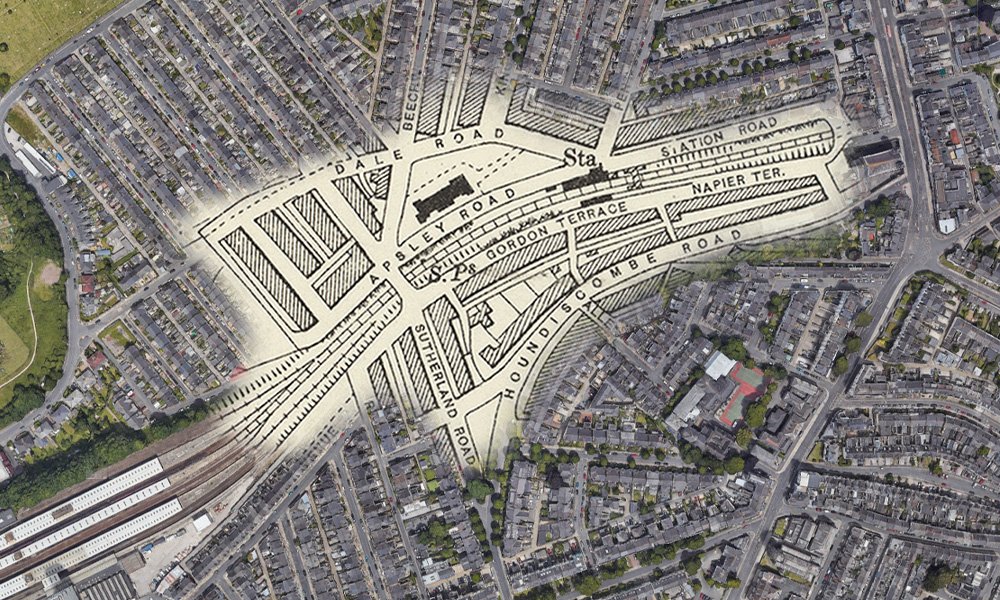
As you can see in the following map, it was a stones throw away from North Road, and just below Mutley Plain. The bottom left shows North Road, and Mutley Plain can be seen on the right hand side.
A History of Mutley
Sadly, there aren’t many images of the station, but thank goodness people did take something.
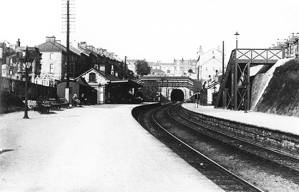
Taken in the 1920s, this was the view from where Napier Car Park now is, looking back towards North Road. In the centre of the image is the building that people of a certain age, remember was the Plymouth Eye Infirmary. – Image by LGRP
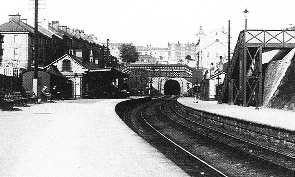
A view of the station showing the southern end of the tunnel, above lies Multey Plain. Adjacent to it can be seen the Baptist Church. Taken circa 1921. Image by LGRP.
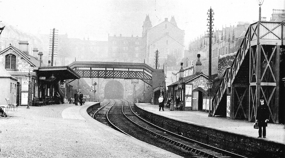
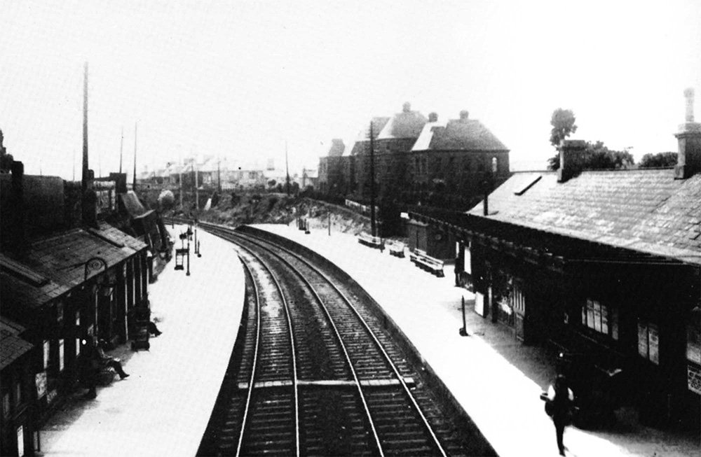
Mutley predates North Road, having opened over five years earlier on the 1st Aug 1871. The signal box near the group on the left had closed by 1896. The is an eastward view, looking towards the tunnel going under Mutley Plain. The GWR and the LSWR had their own booking offices for a period. Image by Lens of Sutton.
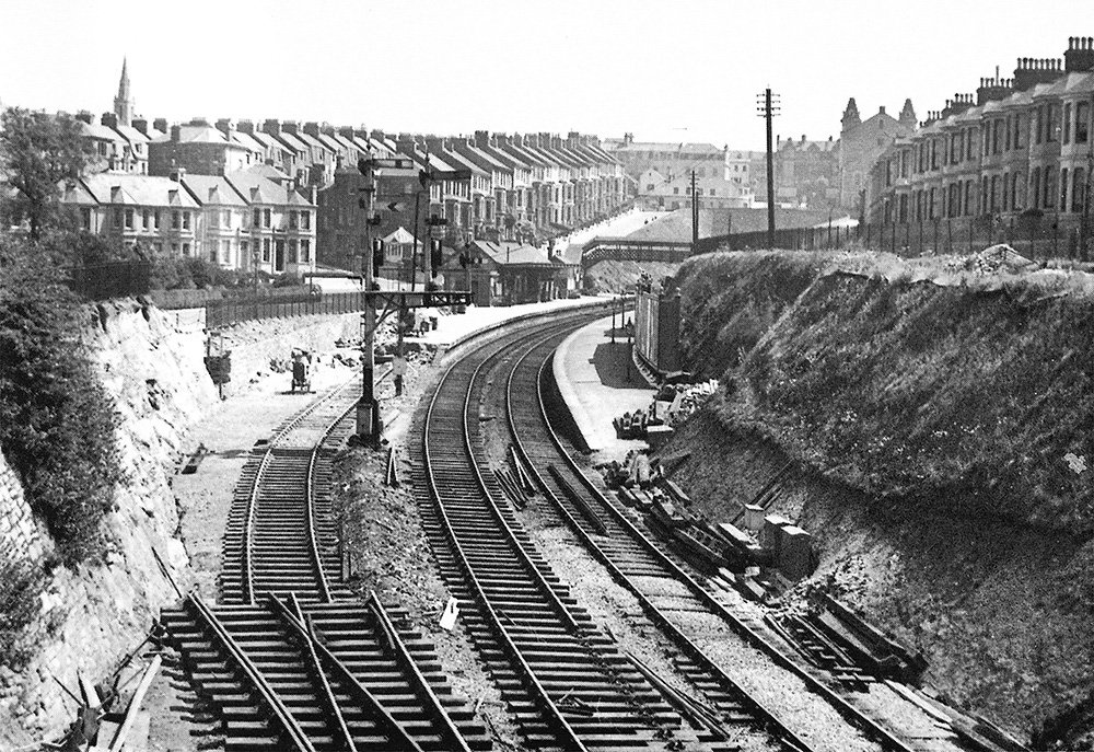
The station was closed on the 3rd of July 1939 and part of the up (GWR designation) platform was removed to allow extension of some of the North Road sidings. Image by M Dart collection.
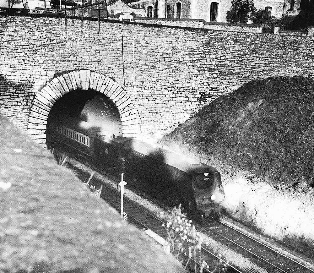
No 34024 “Tamar Valley” emerges from the west end of the 183 yard long Mutley Tunnel on the 14th May 1956, bound for Okehampton. The bore was completed in 1849. The next station was Lipson Vale, which will be the next blog post.
Mutley Station Today
The follow images are from Google Street View.
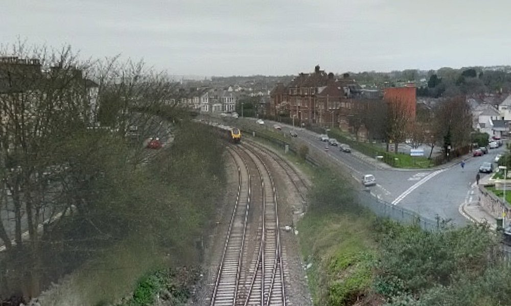
This was taken at the end of Napier Car Park, looking towards the North Road, and the building that used to be the Eye Infirmary. The junction goes off to Apsley Road, with Dale Road branching off to the right. Where all the brushes are, both sides, is where the station was.
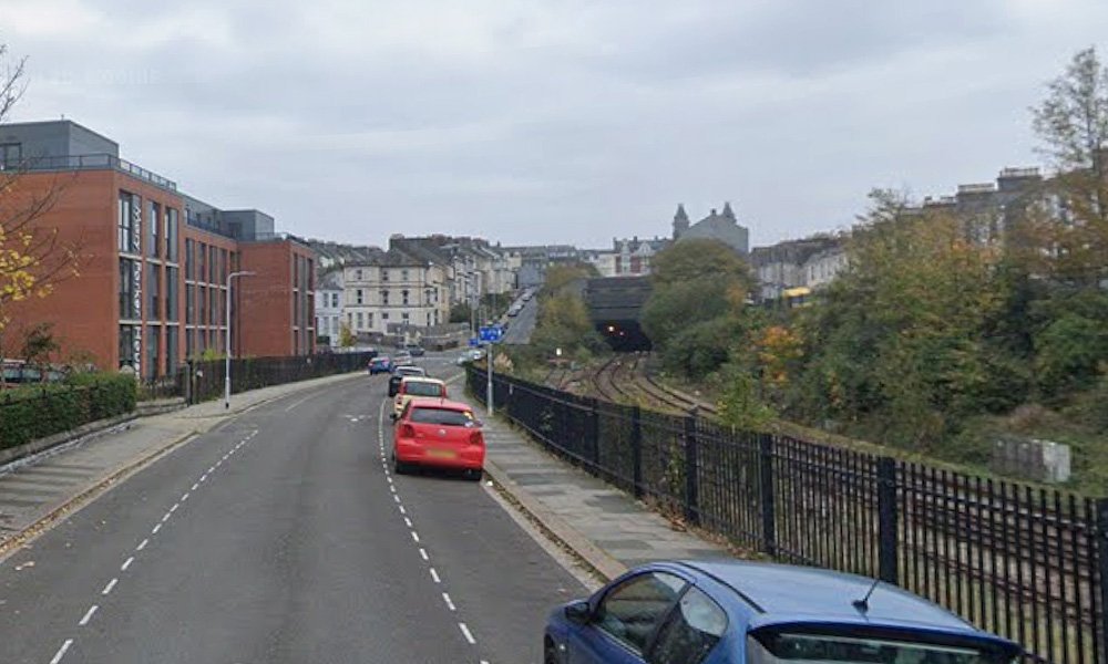
This is from Apsley Road, just beyond the Sutherland Road bridge. You can see Station Road, heading up to Mutley Plain, and just to the right, the tunnel heading under it. Just to the left, and out of shot, would have been the Eye Infirmary, the building you can see is ‘new’, and student accommodation. Again, sadly nothing is left of the station.
Then and Now
I’ve been able to get a couple of Now & Then image, again from the original photos and Google Street View.
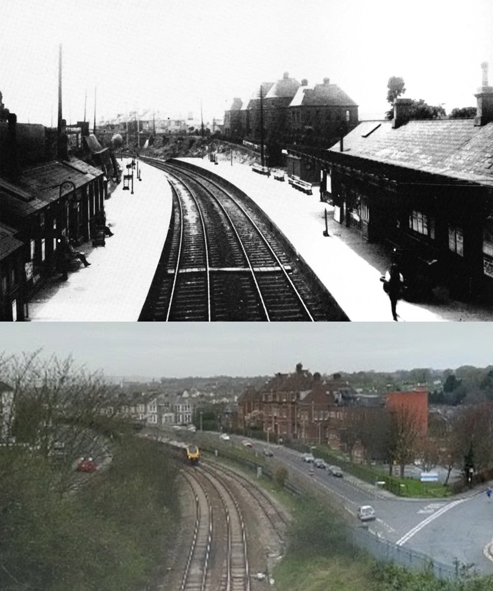
What a difference 100 years makes. The top image is the station, in all it’s glory, showing off the impressive buildings. The bottom image, taken from Napier Car Park, just shows how much it’s over grown.
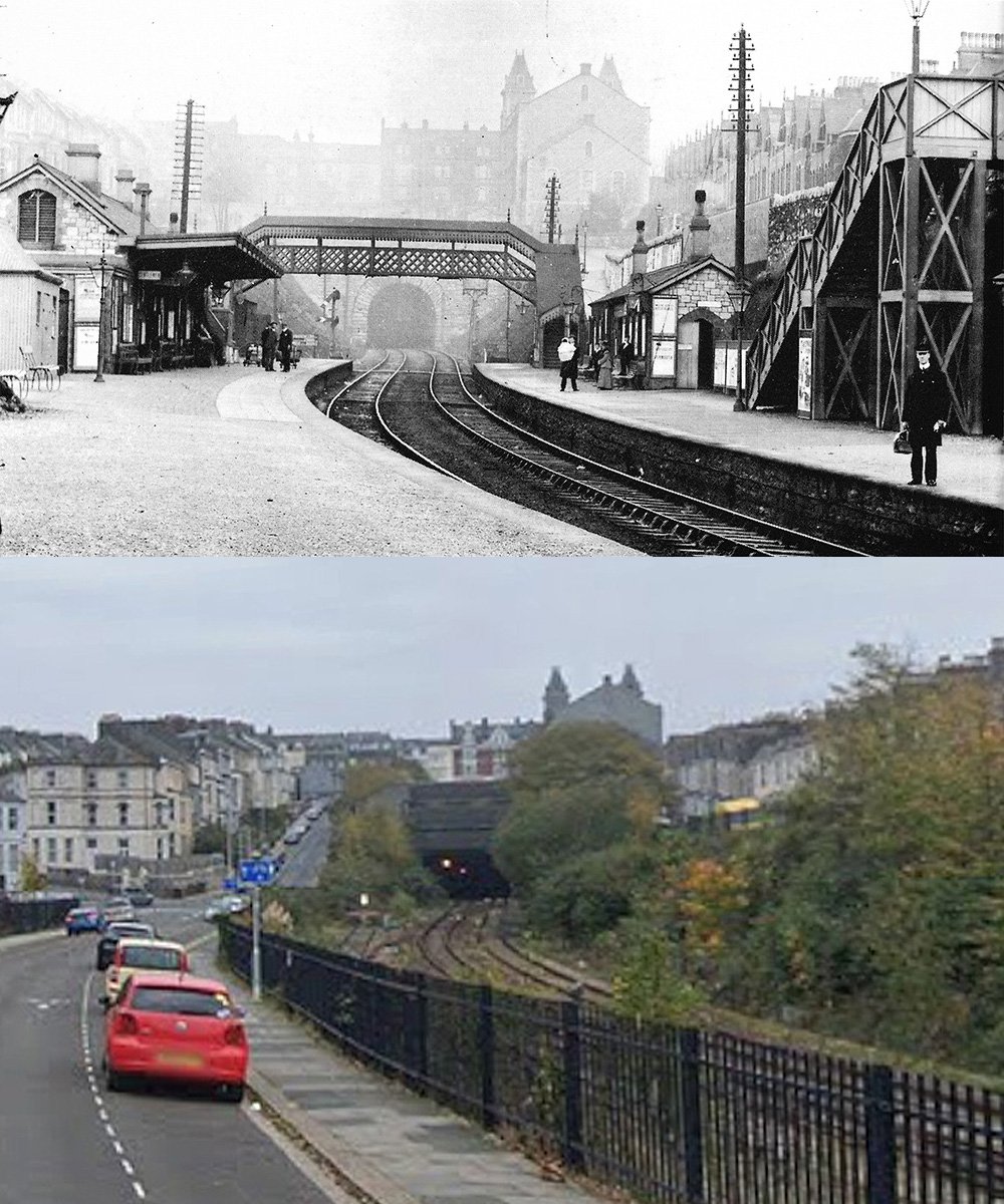
I don’t know about you, but I prefer the image on top.
Next Up
My arm is doing better with the second op I had on it, so I can get back to writing. Next on the line is Lipson Vale Halt, which is missing off my map at the top of this post. That is dad’s fault, he made the original map.
The other good news is I am working on an update of the video Plymouth to Launceston Via Tavistock South. With new images, and I’m hoping to get new filming done. We never sent the helicopter up for an aerial view of the line today, but I plan on taking my drone and getting new footage.
As always, I would like to thank Anthony Kingdom for use of this images from his book The Plymouth, Tavistock and Launceston Railway. Also, thank you to Middleton Press for use of the images from their book, Tavistock to Plymouth, Southern Main Lines.