
The London and South Western Railway trains started arriving in Plymouth in May 1876. Friary Goods Station opened on the 1st February 1878 at the end of a short branch from Friary Junction near Laira on GWR’s Sutton Harbour branch.
On the 1st of July 1891 a new passenger terminus was opened at Friary. The station was towards the east side of Plymouth, facing Beaumont Road, but also with an entrance via Exeter Street.
On the 5th of September 1892 a line was opened across the River Plym to Plymstock, which was extended to Turnchapel on the 1st of January 1897. The GWR also served Plymstock from a direct line from Millbay via Laira en route to Yealmpton, but from 3 November 1941 until 7 October 1947 GWR trains ran from Friary to Yealmpton.
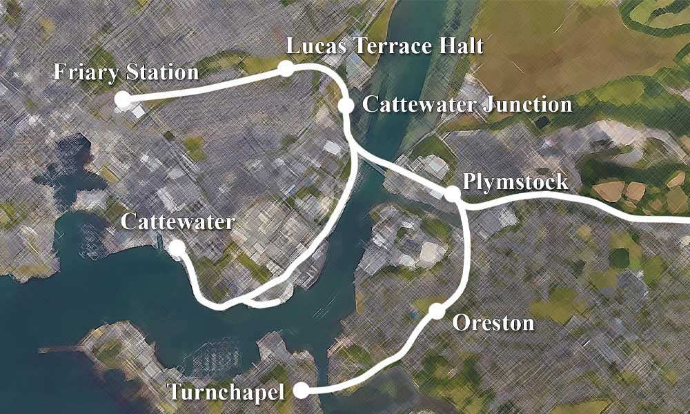
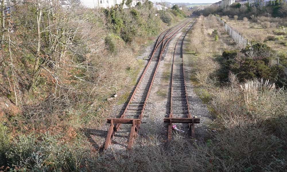
The line out to the east (to the right) was the line out towards Yealmpton.
Photos of Friary
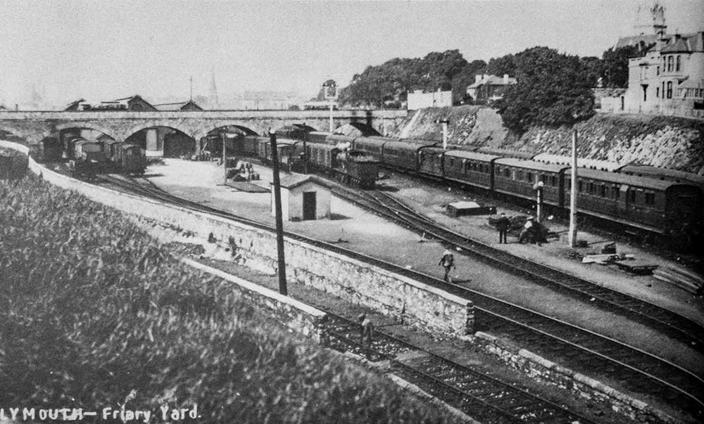
The station yard, east of the station during the 1920s. In the foreground is the North Quay and Sutton Harbour line dropping away to the tunnel under Exeter Street. Image by Anthony Kingdom.
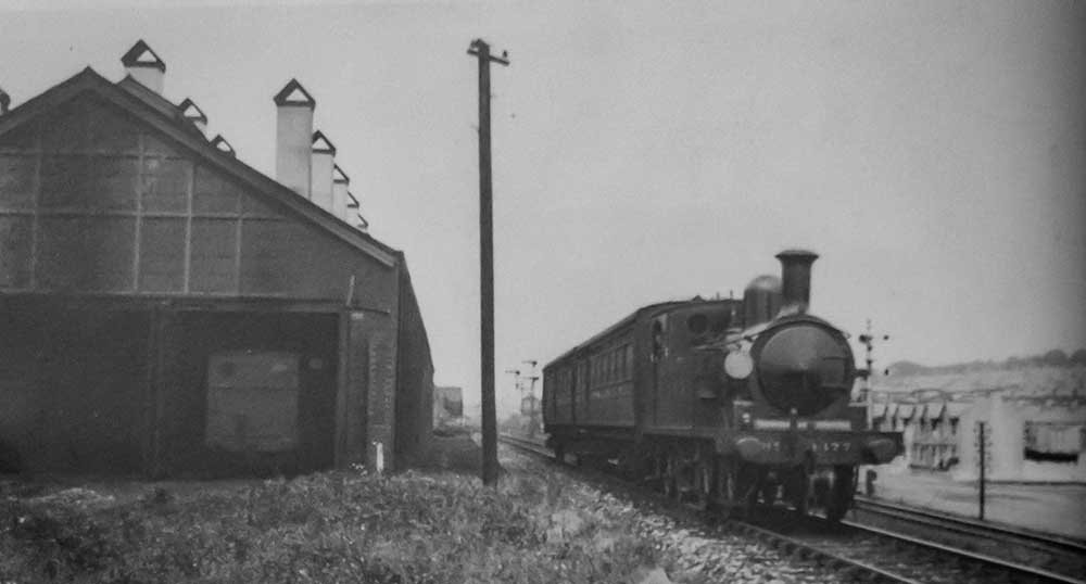
Class O2 No. 177 still in the LSWR livery on the 18th of July 1924, heading the Turnchapel train past the station shed. Image by H. C. Casserley.
A Class O2 No. 225, and one coach from Turnchapel is on the arrival on the Down road at Friary during the 1930s. Image by Lens of Sutton.
This was the main entrance to Friary Station, taken around 1949. Image by W. E. Stevens.
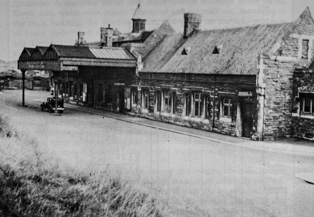
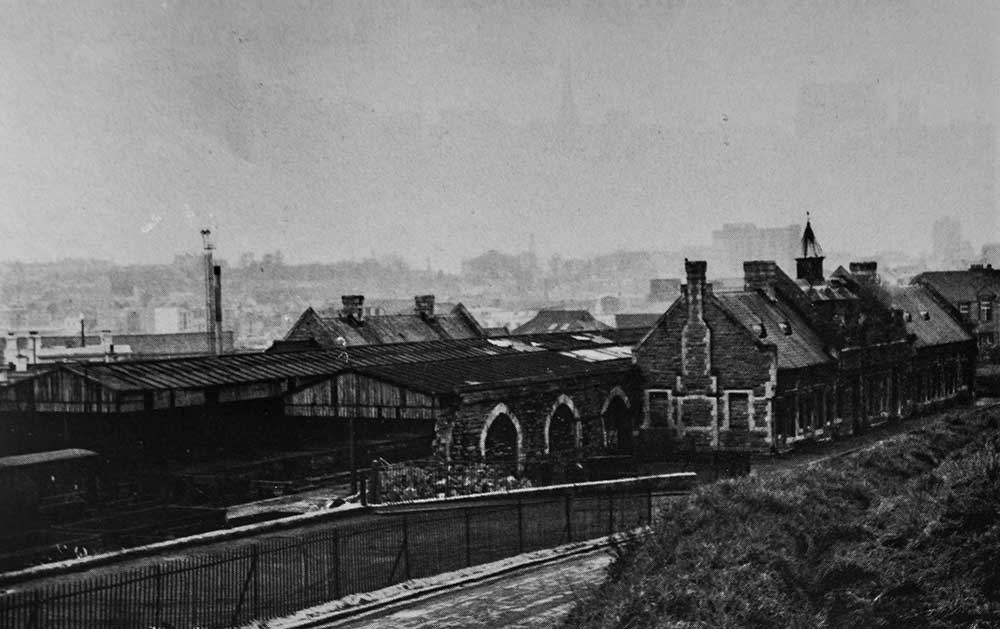
If you stood on the Tothill Road bridge, you could see the full scale of the station. Do you know what the buildings are in the background? I can’t quite figure it out. Taken in the early 1950s. Image by L.G.R.P.
I took this image in 2024, while updating the footage for the Plymouth to Turnchapel Railway. You can clearly see Tothill Road Bridge at the bottom of the photo, and I have circled St Andrew’s Church. I’m not sure that is the church in the background of the photo above though. If you know, please let me know in the comments.
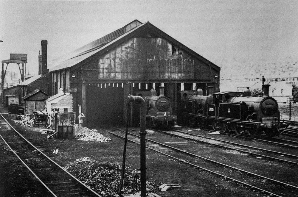
There are three Class M7s standing at the eastern end of Friary Motive Power Depot, during June of 1954. Image by Photomatic Ltd.
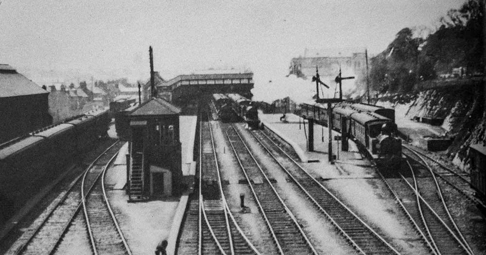
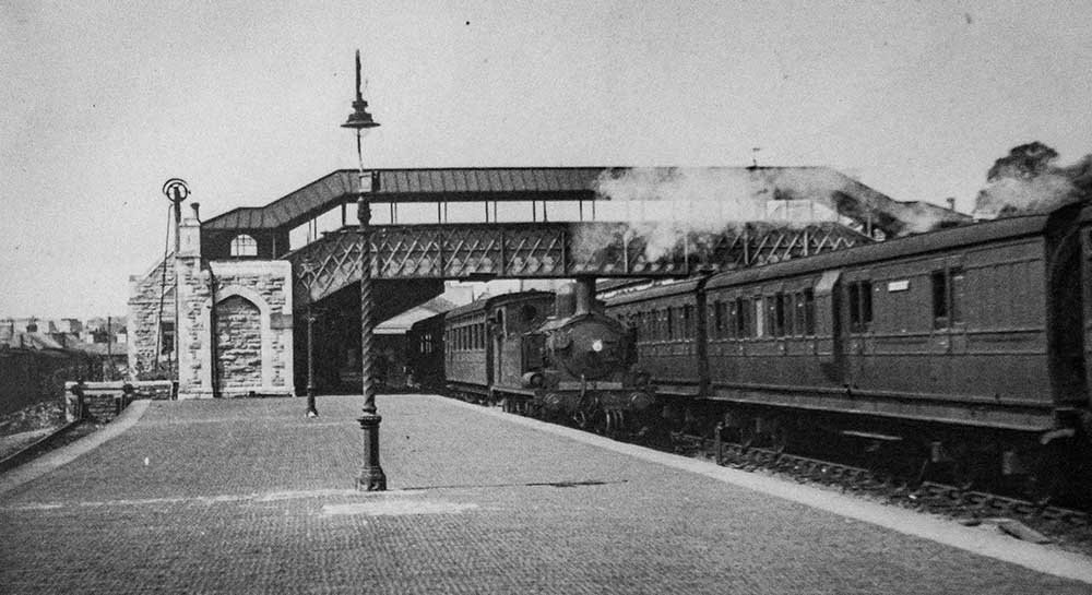
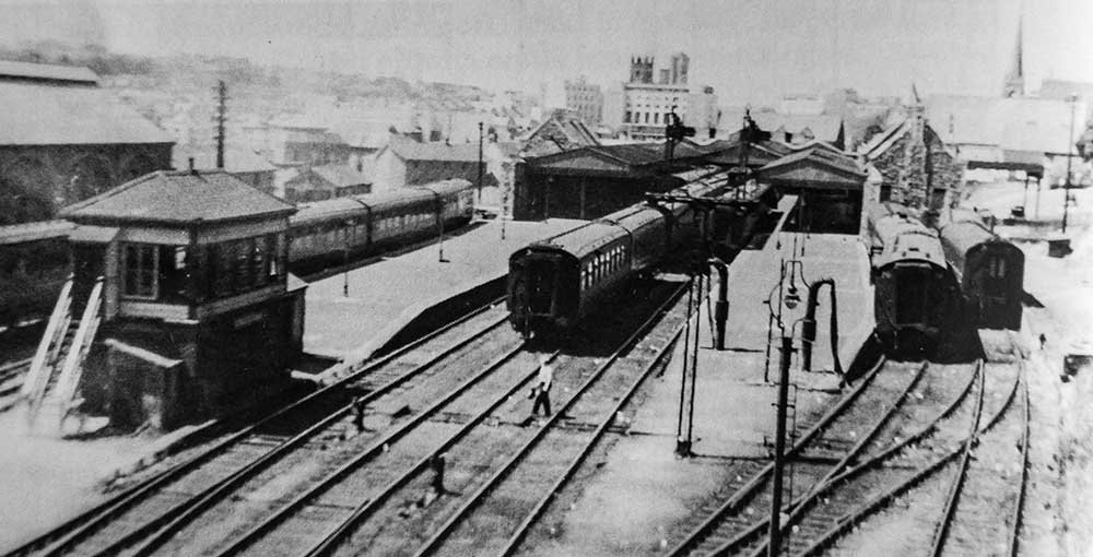
A view of the station in all it’s glory. This was early in the SR days with the Turnchapel train on the extreme right of the picture. A Class O2 No. 233 in charge. Image by Lens of Sutton.
After the closure to passengers
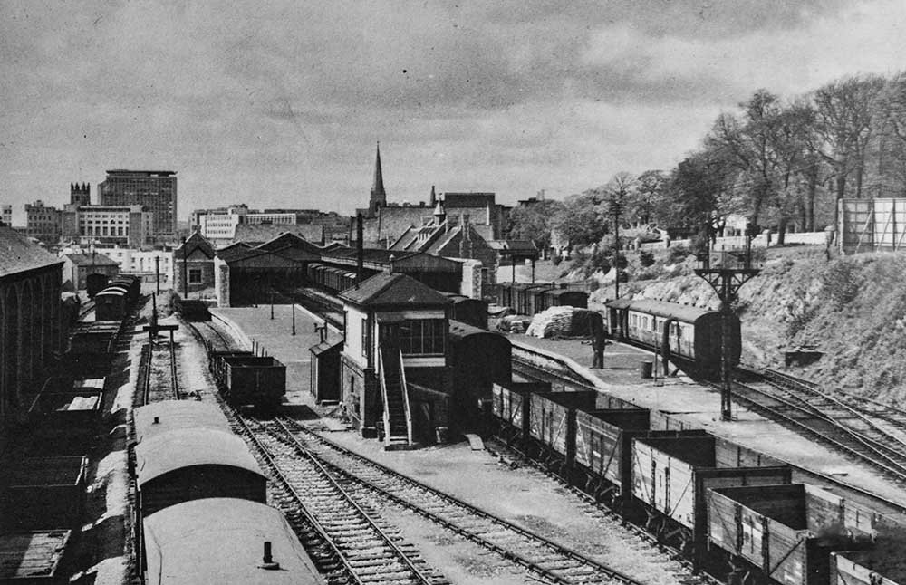
A general view of the station after closure to passengers but prior to demolition of the goods shed, the 5th of May 1963. Image by S. C. Nash.
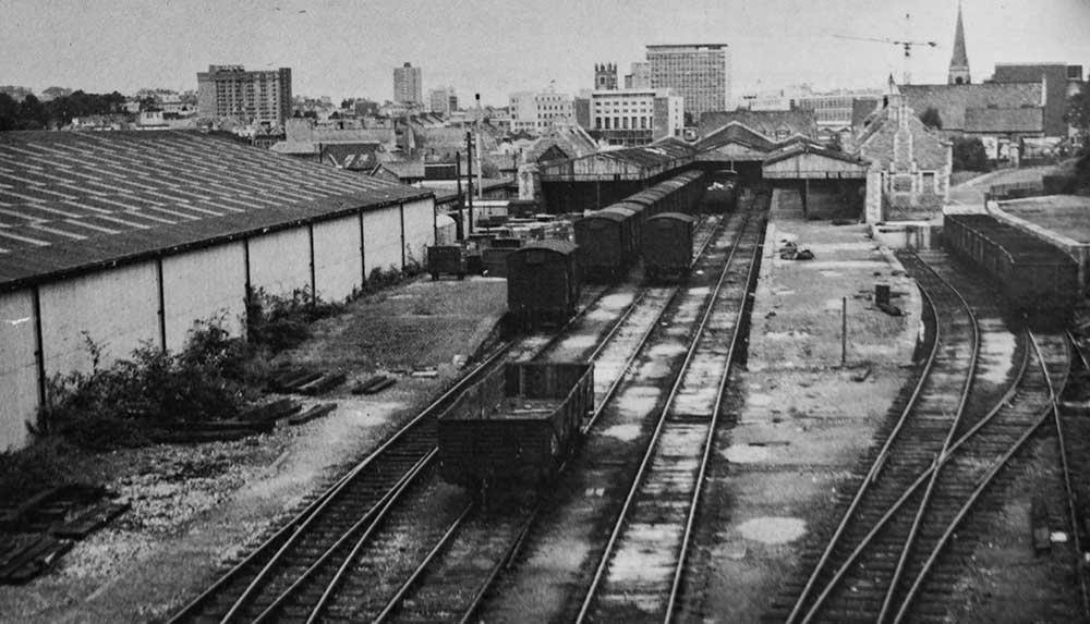
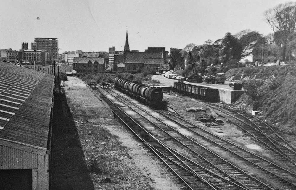
A view of Friary Station in 1967, showing the new freight depot sheds and the then abandoned passenger station with its buildings fast becoming derelict. Image by Pamlin Prints.
The end of Friary Station, at the commencement of its demolition in March of 1976. Image by Anthony Kingdom.
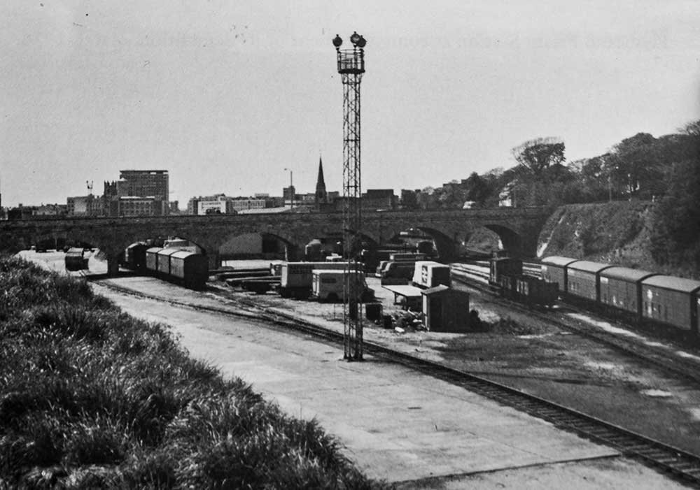
The station site and yard in May of 1981. Then they were used as part of the ‘new’ BR fright handling complex with road/rail transfer facilities for Roadline and other services. Images by Anthony Kingdom.
Friary today
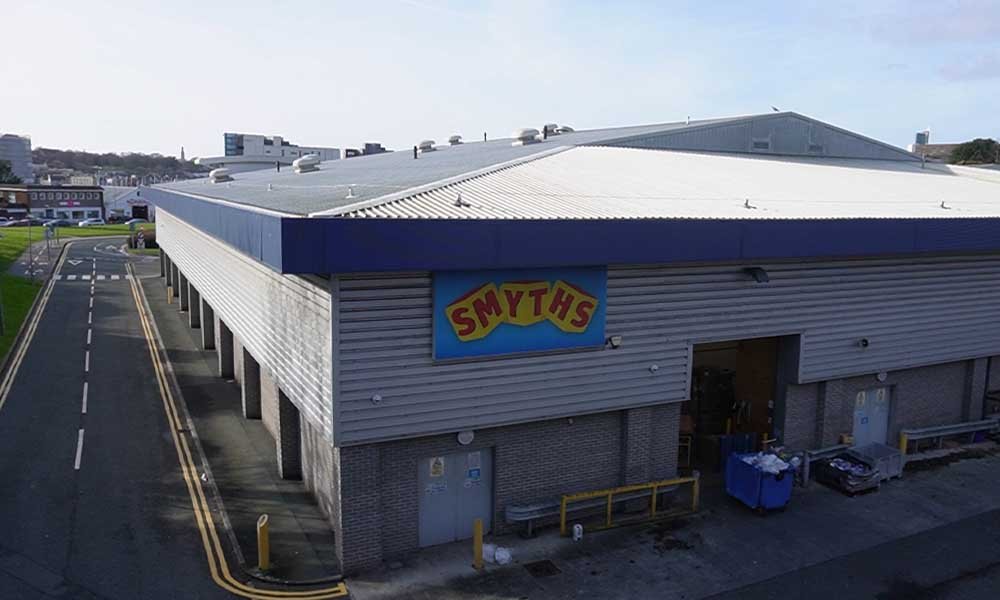
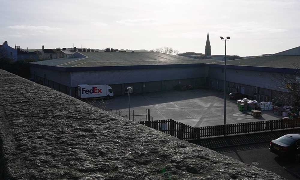
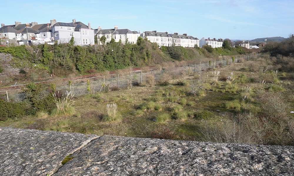
This station is one of the sites I have been able to visit and film, and take photos, of in more modern times. I was there in 2024 and took the following images of Tothill Road and the old site. Images by me.
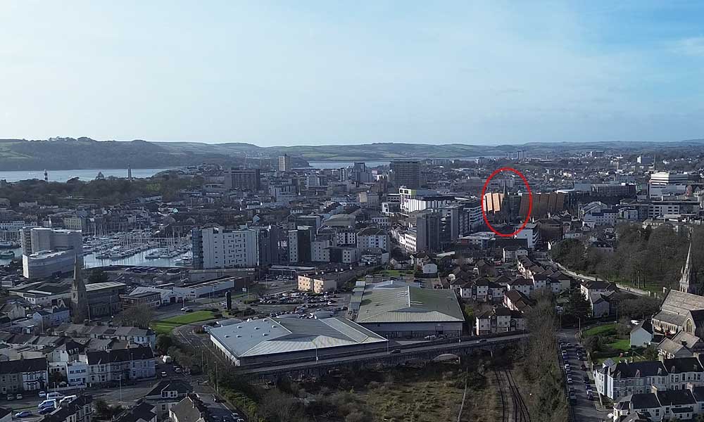
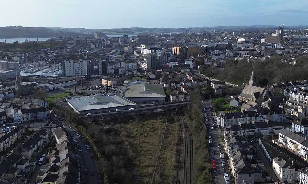
And here is one from the air, you can barely make out where the station was, which is sad to see.
Thank to Anthony Kingdom for letting me use the images from his book, The Turnchapel Branch, including The Cattewater Goods Branch. Other information was from Wikipedia.
More blog posts about closed stations are on the way, you can subscribe below. Thank you for reading. For more about the Turnchapel Branch Line, here is a video based on Anthony’s book.